IODP Maps for Papers and Presentations
The maps are available free of charge for use in papers and presentations. They were produced with GMT using GEBCO data (Expeditions 320T–340: GEBCO One Minute Grid, version 2.0, Expeditions 342–346: GEBCO_08 Grid, version 20100927). The maps use Mercator or Stereographic (polar regions) projections. If you have questions or suggestions, please contact Brittany Stockmaster.
|
Expedition 346: Asian Monsoon |
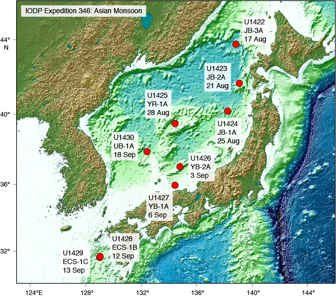 Site Map Preview AI file (19 Mb) PDF file (10 Mb) |
Transit Map Preview AI file (13 Mb) PDF file (7 Mb) |
|
Expedition 341: Southern Alaska Margin Tectonics, Climate & Sedimentation |
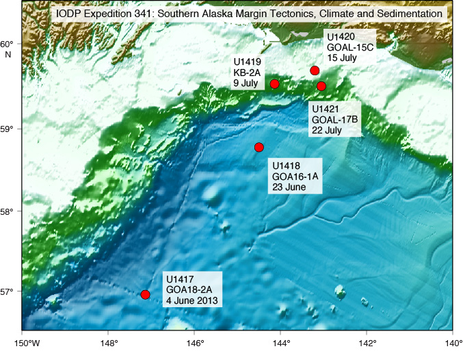 Site Map Preview AI file (13 Mb) PDF file (7 Mb) |
Transit Map Preview AI file (14 Mb) PDF file (7 Mb) |
|
Expedition 341S: SCIMPI & 858G CORK |
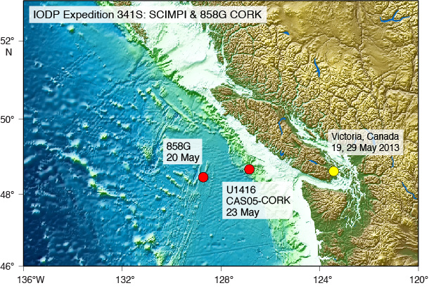 Site & Transit Map Preview AI file (11 Mb) PDF file (6 Mb) | |
|
Expedition 345: Hess Deep Plutonic Crust |
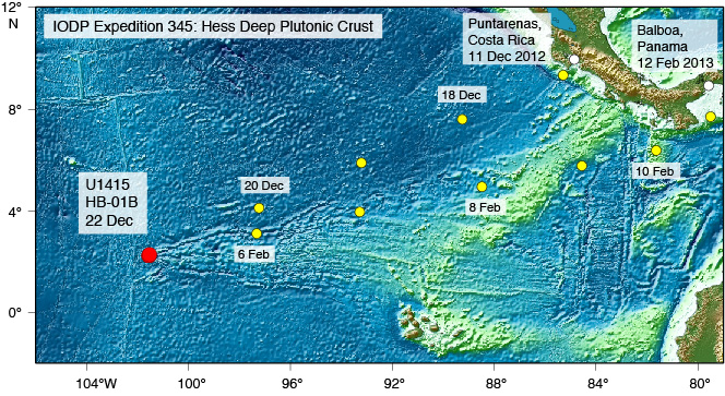 Site & Transit Map Preview EPS file (20 Mb) PDF file (6 Mb) | |
|
Expedition 344: Costa Rica Seismogenesis Project 2 |
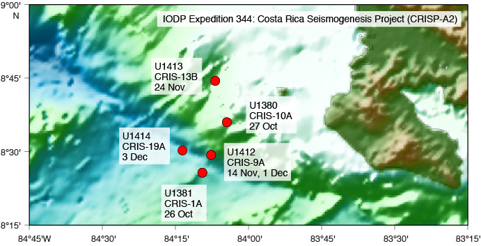 Site Map Preview EPS file (11 Mb) PDF file (8 Mb) |
Transit Map Preview EPS file (18 Mb) PDF file (12 Mb) |
|
Expedition 342: Paleogene Newfoundland Sediment Drifts |
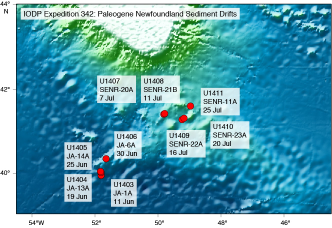 Site Map Preview EPS file (20 Mb) PDF file (13 Mb) |
Transit Map Preview EPS file (25 Mb) PDF file (15 Mb) |
|
Expedition 340: Lesser Antilles Volcanism and Landslides |
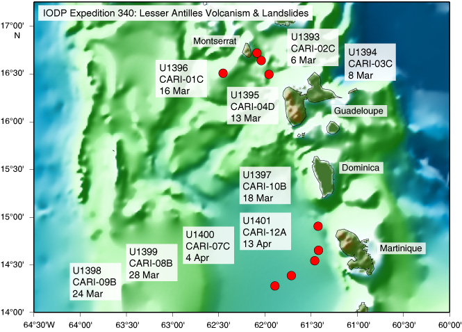 Site Map Preview EPS file (14 Mb) PDF file (11 Mb) |
Transit Map Preview EPS file (15 Mb) PDF file (11 Mb) |
|
Expedition 340T: Atlantis Massif Oceanic Core Complex |
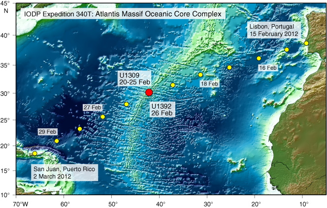 Site & Transit Map Preview EPS file (20 Mb) PDF file (7 Mb) | |
|
Expedition 339: Mediterranean Outflow |
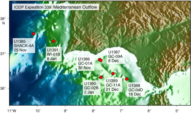 Site Map Preview EPS file (16 Mb) PDF file (12 Mb) |
Transit Map Preview EPS file 18 Mb) PDF file (13 Mb) |
|
Expedition 336: Mid-Atlantic Ridge Microbiology |
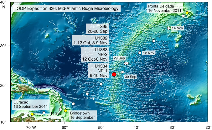 Site & Transit Map Preview EPS file (20 Mb) PDF file (13 Mb) | |
|
Expedition 335: Superfast Spreading Rate Crust |
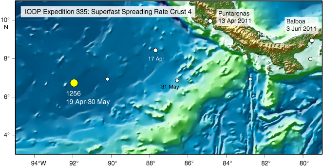 Site & Transit Map Preview EPS file (13 Mb) PDF file (9 Mb) | |
|
Expedition 334: Costa Rica Seismogenesis Project |
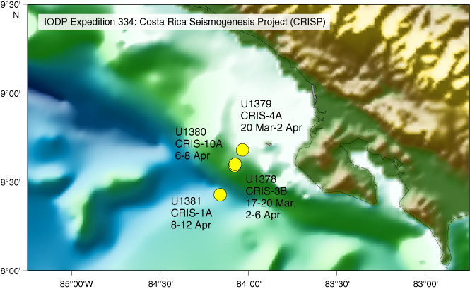 Site Map Preview EPS file (12 Mb) PDF file (9 Mb) |
Transit Map Preview EPS file 14 Mb) PDF file (11 Mb) |
|
Expedition 330: Louisville Seamount Trail |
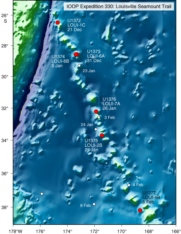 Site Map Preview EPS file (18 Mb) PDF file (12 Mb) |
Transit Map Preview EPS file 13 Mb) PDF file (10 Mb) |
|
Expedition 329: South Pacific Gyre Microbiology |
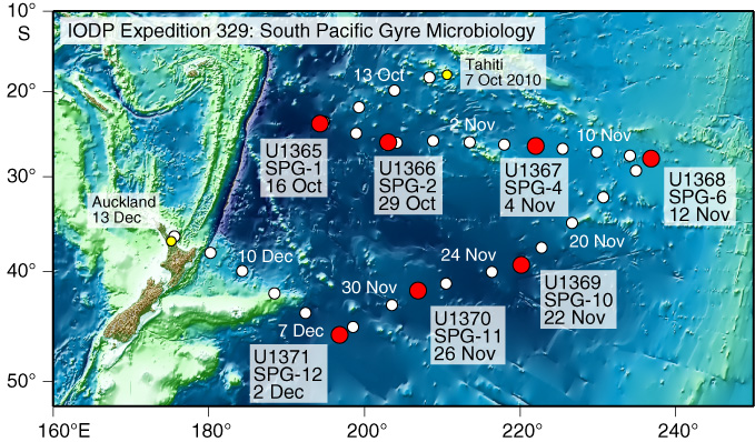 Site & Transit Map Preview EPS file (9 Mb) PDF file (6 Mb) | |
|
Expedition 328: Cascadia ACORK Observatory |
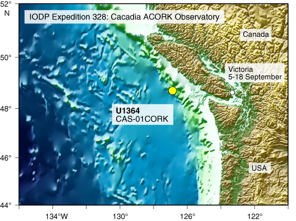 Site Map Preview EPS file (11 Mb) PDF file (8 Mb) | |
|
Expedition 327: Juan de Fuca Hydrogeology |
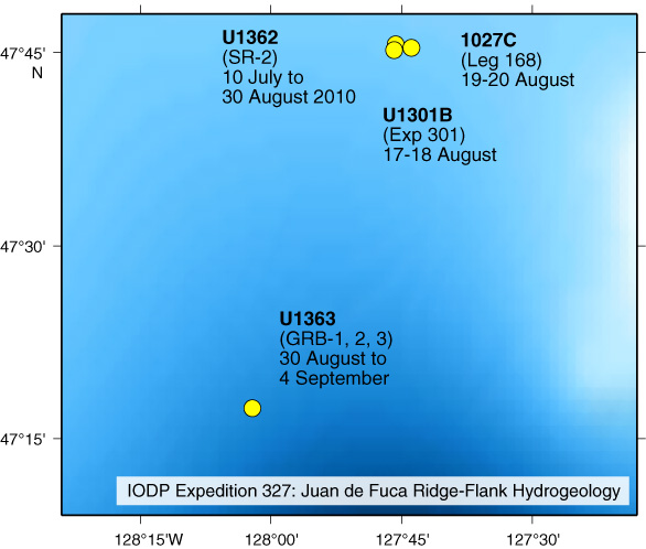 Site Map Preview EPS file (2 Mb) PDF file (8 Mb) |
Transit Map Preview EPS file 12 Mb) PDF file (8 Mb) |
|
Expedition 318: Wilkes Land Glacial History |
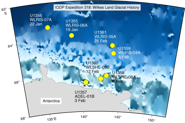 Site Map Preview EPS file (11 Mb) PDF file (8 Mb) |
Transit Map Preview EPS file (17 Mb) PDF file (7 Mb) |
|
Expedition 317: Canterbury Basin Sea Level |
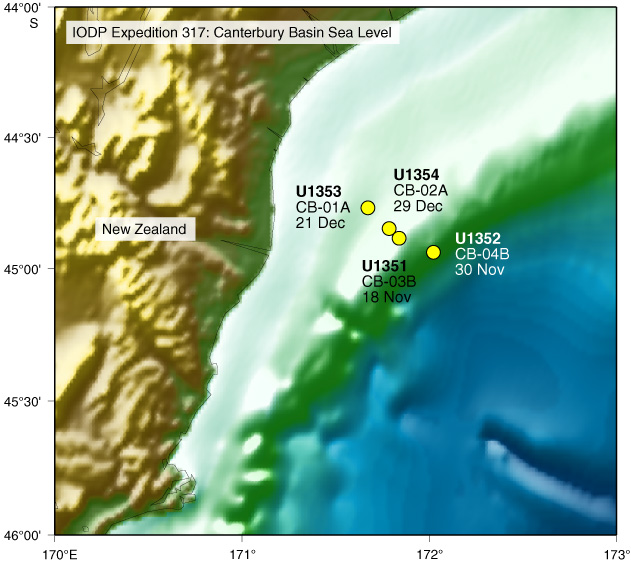 Site Map Preview EPS file (12 Mb) PDF file (9 Mb) |
Transit Map Preview EPS file (26 Mb) PDF file (10 Mb) |
|
Expedition 324: Shatsky Rise Formation |
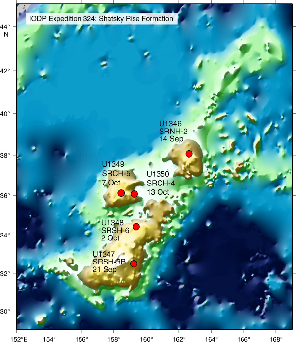 Site Map Preview EPS file (13 Mb) PDF file (7 Mb) |
Transit Map Preview EPS file (19 Mb) PDF file (11 Mb) |
|
Expedition 323: Bering Sea Paleoceanography |
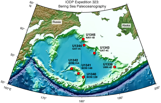 Site Map Preview EPS file (11 Mb) PDF file (4 Mb) |
Transit Map Preview EPS file (16 Mb) PDF file (5 Mb) |
|
Expedition 321T: Juan de Fuca Cementing |
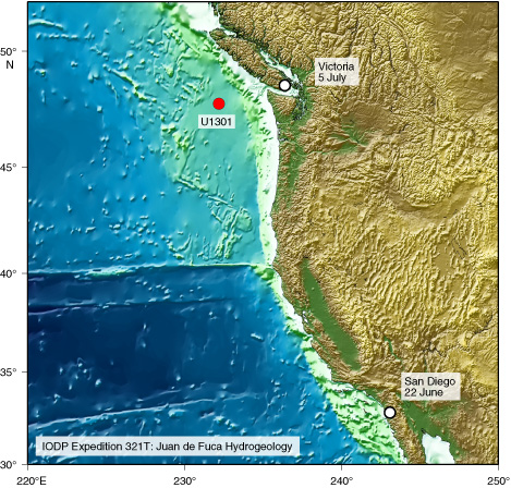 Site Map Preview EPS file (21 Mb) PDF file (15 Mb) | |
|
Expedition 320/321: Pacific Equatorial Age Transect |
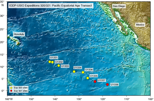 Site Map Preview EPS file (19 Mb) PDF file (12 Mb) | |
|
Expedition 320T: Sea Trials |
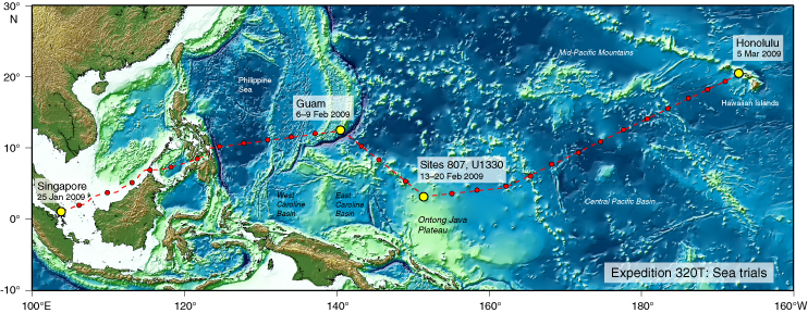 Site & Transit Map Preview EPS file (21 Mb) PDF file (7 Mb) | |